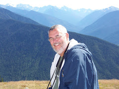
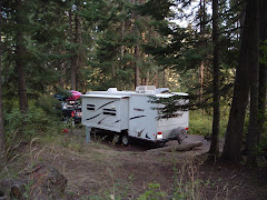
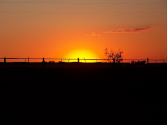
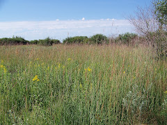
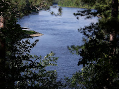
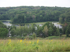
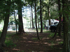
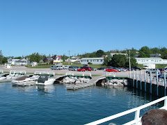
Well today Wednesday July 30th we left Michigan, but now before stopping at the Kewadin Casino in Christmas, Michigan. We took in $20.00 each and came out with $0.00 each. What a great land that you can go to the casino at 9:00 a.m. on your way to your next stop.
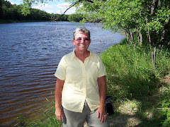
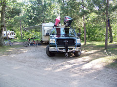
We stopped in Marquette, Michigan and visited Wal-Mart for a few supplies. We arrived in Woodruff after 226 miles of driving and entering the Central Time Zone. We are at this nice campground with wifi and electricity.
We leave on Thursday to go to Brunet State Park. We probably will be without services again.
Until next time.....
Thursday, July 31, 2008
Wednesday, July 30, 2008
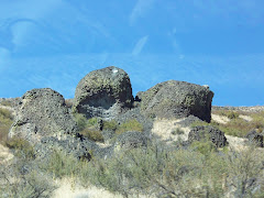
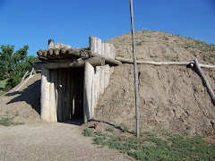
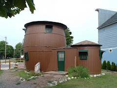
Pickle House Grand Marais Michigan
The Pioneer Cooperage Co. of Chicago designed this vacation cottage in 1926 build for William Donahey creator of “The Teanie Weinies”. The main barrel consisted of a living area on the first floor and bedroom on the second. The smaller barrel is the kitchen. Donahey spent 10 summers at the cottage with his wife Mary. The Pickle Barrel House is listed in the National Register of Historic places
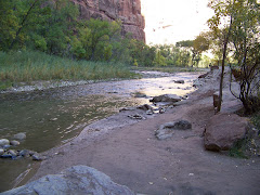
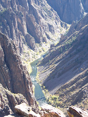
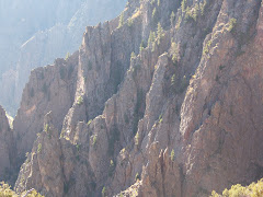
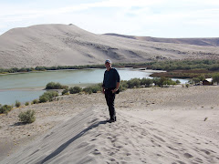
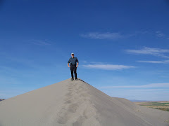
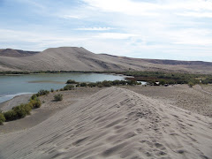
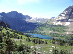
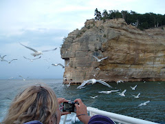
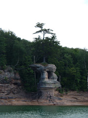
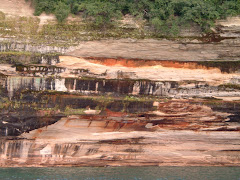
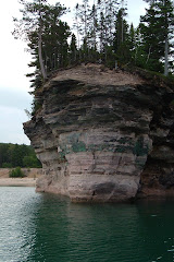
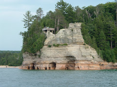
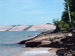
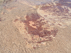
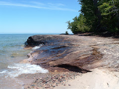
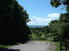
Pictured Rocks Lakeshore
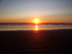
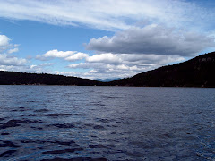
On Tuesday evening July 29th, we took a sunset cruise on Lake Superior to see the Pictured Rocks. It was so beautiful.
The brochure gives the following information about Pictured Rocks: “Massive glaciers inched back and forth across this land for a million years, scouring and molding, while the land yielded and took on a new shape. Moving ice ground the volcanic and sedimentary rock of previous eras into rubble and slowly enlarged river valleys into the wide basins that would become the Great Lakes. The last glacier began its retreat about 10,000 years ago. Overt time meltwater from this wasting glacier formed powerful rivers and scattered rubble onto outwash plain and into crevasses. The water scooped out basins and channels hat harbor the wetlands found in the park today. Eventually, as the weight of the glacier lessened, the land rose and exposed bedrock to lake erosion. It was this onslaught by the lake-centuries of battering waves and ice—that carved the bedrock into young cliffs. Relentlessly the water continues to pound and sculpt the cliffs, eroding them inland while enlarging the lake.
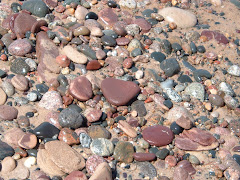
Solid or liquid, the force of the water profoundly altered the landscape an created the largest freshwater lake system in the world. The name “pictured rocks” comes from the streaks of mineral stain that decorate the face of the sculpted cliffs. The Munising Formation makes up much of the angled slope and formations, such as Miner’s Castle. Covering all is the 400 million-year-old Ordovician Au Train Formation, a harder limy sandstone that serves as capstone and protects the underlying sandstone from rapid erosion. The streaks on the cliffs occur when groundwater oozes out of cracks. The dripping water contains iron, manganese, limonite, copper, and other minerals that leave behind a color stain as water trickles down the cliff face.
The brochure gives the following information about Pictured Rocks: “Massive glaciers inched back and forth across this land for a million years, scouring and molding, while the land yielded and took on a new shape. Moving ice ground the volcanic and sedimentary rock of previous eras into rubble and slowly enlarged river valleys into the wide basins that would become the Great Lakes. The last glacier began its retreat about 10,000 years ago. Overt time meltwater from this wasting glacier formed powerful rivers and scattered rubble onto outwash plain and into crevasses. The water scooped out basins and channels hat harbor the wetlands found in the park today. Eventually, as the weight of the glacier lessened, the land rose and exposed bedrock to lake erosion. It was this onslaught by the lake-centuries of battering waves and ice—that carved the bedrock into young cliffs. Relentlessly the water continues to pound and sculpt the cliffs, eroding them inland while enlarging the lake.
Solid or liquid, the force of the water profoundly altered the landscape an created the largest freshwater lake system in the world. The name “pictured rocks” comes from the streaks of mineral stain that decorate the face of the sculpted cliffs. The Munising Formation makes up much of the angled slope and formations, such as Miner’s Castle. Covering all is the 400 million-year-old Ordovician Au Train Formation, a harder limy sandstone that serves as capstone and protects the underlying sandstone from rapid erosion. The streaks on the cliffs occur when groundwater oozes out of cracks. The dripping water contains iron, manganese, limonite, copper, and other minerals that leave behind a color stain as water trickles down the cliff face.
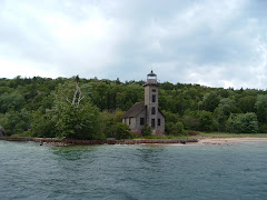
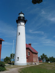
Au Sable Point Lighthouse
The Au Sable Light Station is located on Au Sable Point, originally called Point Aux Sables by the French, who named it for the nearby Grande Sable Dunes.
At least as early as 1622, when Pierre Esprit Radisson called it “most dangerous when there is any storms, Au Sable Point was recognized as a hazard to Lake Superior mariners. When lake traffic began to boom in the middle nineteenth century with the opinion of the Soo Canal (1855) the reef at Au Sable Point was particularly dangerous. Unless warned off, vessels could become victim to this reef of Jacobsville Sandstone which, in some places, lies only a few feet below the surface.
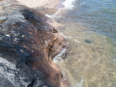
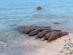
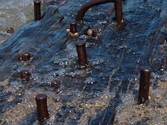
Mary Jarecki—the first wreck east of Twelvemile Beach is this wooden bulk freight streamer, victim of a July 4, 1883, stranding. The ship, heavily laden with iron ore, ran off its course and ground ashore in fog off the mouth of Hurricane River. Today, the remains may still be seen resting on the bare sandstone bottom just outside the breakers near the lighthouse. The long oak keelsons, studded with iron treenails, are just above water. No lives were lost in the incident.
At least as early as 1622, when Pierre Esprit Radisson called it “most dangerous when there is any storms, Au Sable Point was recognized as a hazard to Lake Superior mariners. When lake traffic began to boom in the middle nineteenth century with the opinion of the Soo Canal (1855) the reef at Au Sable Point was particularly dangerous. Unless warned off, vessels could become victim to this reef of Jacobsville Sandstone which, in some places, lies only a few feet below the surface.
Mary Jarecki—the first wreck east of Twelvemile Beach is this wooden bulk freight streamer, victim of a July 4, 1883, stranding. The ship, heavily laden with iron ore, ran off its course and ground ashore in fog off the mouth of Hurricane River. Today, the remains may still be seen resting on the bare sandstone bottom just outside the breakers near the lighthouse. The long oak keelsons, studded with iron treenails, are just above water. No lives were lost in the incident.
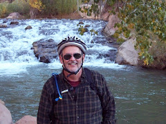
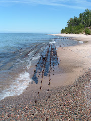
Hurricane River National Forest Campground in Picture Rock Lakeshore
We left Tahquamenon Falls State Park on Monday July 28th and headed west. We decided to take a road to the north and landed up in Pictured Rocks Lakeshore. This is a national park. We went to the visitor’s center and discovered that there are many campsites you can go to along this coast. We drove about 7 miles, 1 of which was dirt, and stopped at Hurricane River Camping. There are only 11 sites here but we were lucky to get a spot.
While we were at the visitor’s center, Dad got a Senior pass that lets us camp at National Parks and Forests for half price. We paid $7.00 for tonight. There are pit toilets and a water spigot. We then took about a 2 miles walk to the Au Sable Light House. It was beautiful. We walked back along Lake Superior. The water was beautiful as were the rocks.
We also saw remains of a shipwreck. The Mary Jarecki was the first wreck east of Twelvemile Beach. The ship, heavily laden with iron ore, ran off its course and ground ashore in a fog off the mouth of Hurricane River. This happened on July 4, 1883. The remains can still be seen resting on the bare sandstone bottom just outside the breakers near the trail we took to the lighthouse. The long oak keelsons, studded with iron treenails, are just above water. No lives were lost in the incident.
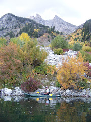
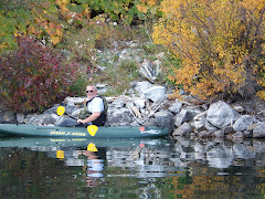
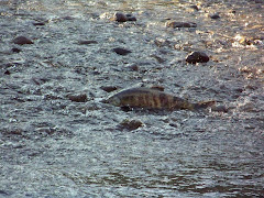
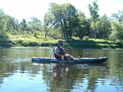
Kayaking on Tahquamenon and talking with a "Yooper" about living and snowmobiling on the Upper Peninsula
On our way home we went on an access road to Tahquamenon Bay. We had to go down a dirt road. It was so beautiful. We decided to go kayaking. We went down the bay and headed towards Emerson Island where there was a logging mill many years ago. You can see the wooded posts still in the water. The water was not very deep. We continued on down the bay. It was so quiet and peaceful. We decided to turn around and head back and the wind came up. It was very difficult to paddle back but we had to keep going. The water was so shallow that at one point I had to get out of the kayak and push it into deeper water. I was so exhausted by the time we got back to the truck. We were starting to load the kayaks when a gentleman, Mike, came to let his dog swim in the bay. We talked with him for awhile. He gave us some great insight into the life on the upper peninsula in the winter. His home is 7 miles from the main road and in the winter they have to take snowmobiles to the main road in order to get to work. His daughter takes the snowmobile to the main road and then gets the school bus. He belongs to a snowmobile club and they groom about 110 miles of snowmobile routes in the winter.
Tahquamenon Falls State Park has its own brewery and it is opened all year long. His snowmobiles club goes there quite often to meet other clubs. In the winter he says you can see about 30 cars and 300 snowmobiles at the restaurant.
Tahquamenon Falls State Park has its own brewery and it is opened all year long. His snowmobiles club goes there quite often to meet other clubs. In the winter he says you can see about 30 cars and 300 snowmobiles at the restaurant.
Cenennial Cranberry Farm
On Monday we went to the Cranberry Capital of Michigan. We went to a cranberry bog. I don’t believe it has been in harvest for awhile; however, we got to see the equipment they use and watched a video. It costs $5.00 each to go through on a self-guided tour. Dad bought some cranberry syrup and some cranberry sauce. He had the syrup on pancakes on Monday morning.
Cranberries are harvested in late fall. The cranberry bogs are flooded and then they use a machine that vibrates the berries off the plants and then they usea boomboard and boom them together. They are then put on a conveyor belt to get them out of the bog.
Centennial Cranberry Farm has a water reel beater that was constructed by a talented neighbor. The berries they harvest for juice and sauce are sold to Cliffstar Crporation of Dunkirk, New York. Cliffstar is the largest private label processor in this country and processes cranberry, grape and apple juice for Walmart, Sam's brand.
The Centennial Cranberry Farm was purchased by John Clarke from the U.S. Government in 1876 and has been in the same famiy for 130 years.
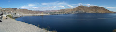
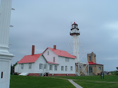
Great Lakes Shipwreck Museum, Whitefish Bay
We also visited the oldest working lighthouse on Lake Superior—Whitefish Point Lighthouse. In 1861 President Abraham Lincoln had the lighthouse keeper’s quarters built. The lens had to be rewound every 2 ½ hours and therefore had to have two lighthouse keepers. The quarters housed the families of the lighthouse keeper and lighthouse keeper’s assistant. It was a very lonely life but these men were dedicated to their job. The woodwork and hard wood floors in the quarters are original from 1861. We also went into the Life Saving Service building which houses a replica of a rescue boat. There were 8 men who would take this boat and rescue the people from the ships at sea.
What an awesome place. The museum had stories and artifacts from many shipwrecks that have occurred on Lake Superior. The most famous being the Edmund Fitzgerald in 1975. We also watched a video on the Edmund Fitzgerald and its 17 year history carrying iron ore and steel across Lake Superior.
What an awesome place. The museum had stories and artifacts from many shipwrecks that have occurred on Lake Superior. The most famous being the Edmund Fitzgerald in 1975. We also watched a video on the Edmund Fitzgerald and its 17 year history carrying iron ore and steel across Lake Superior.
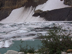
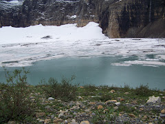
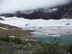
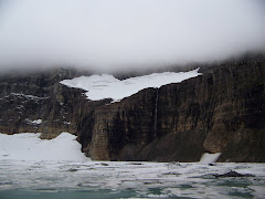
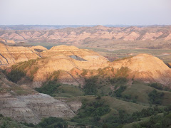
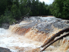
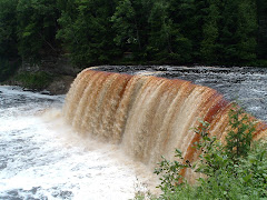
Tahquamenon State Park, Upper Peninsula, Michigan
Friday July 24th
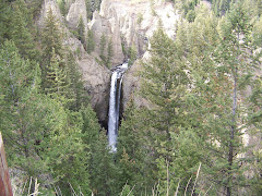
We left the KOA in Newberry, Michigan and drove 36 miles north to Tahquamenon (pronounced like phenomenon) State Park. What a beautiful place. We have a corner campsite that is large and comfortable.
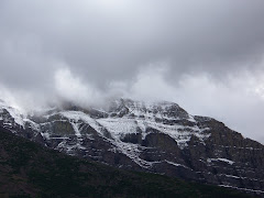
Today, Saturday July 25th we visited the upper and lower falls of the Tahquamenon River. The brochure for the state park says, “Rising from springs north of McMillan and drains the watershed of an area of more than 790 square miles. From its source, it meanders 94 miles before emptying into Whitefish Bay. The amber color of the water is not rust nor is it muddiness; it is caused by tannin leached from the Cedar, Spruce, and Hemlock in the swamps drained by the river. The extremely soft water churned by the action of the falls causes the large amounts of foam, which has been the trademark of the Tahquamenon since the days of the voyagers.”
We left the KOA in Newberry, Michigan and drove 36 miles north to Tahquamenon (pronounced like phenomenon) State Park. What a beautiful place. We have a corner campsite that is large and comfortable.
Today, Saturday July 25th we visited the upper and lower falls of the Tahquamenon River. The brochure for the state park says, “Rising from springs north of McMillan and drains the watershed of an area of more than 790 square miles. From its source, it meanders 94 miles before emptying into Whitefish Bay. The amber color of the water is not rust nor is it muddiness; it is caused by tannin leached from the Cedar, Spruce, and Hemlock in the swamps drained by the river. The extremely soft water churned by the action of the falls causes the large amounts of foam, which has been the trademark of the Tahquamenon since the days of the voyagers.”
Thursday, July 24, 2008
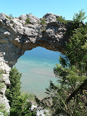
Mackinac Island
Today we visited Mackinac Island. We drove about 60 miles south to St. Ignace to the ferry. We took our bikes with us and boarded Shepler's Ferry Service to the Island. It was a 16 minute ride. The view was breathtaking and the weather was sunny and beautiful. Once we arrived at the island, we got on our bikes and began the shore ride along the coast. You could see different shades of blue in the water depending where you were.
There are no automobiles on Mackinac Island. They have been forbidden since 1898. People get around by bicycles, horse drawn wagons, and foot. You can rent a horse and buggy if you choose. They have bikes for rent, and you can take a taxi which his a horse and wagon.
We stopped at many interesting points along the way. For instance we stopped and climbed the stairs to Arch Rock. It towers 146 feet above the road. The Arch rock is a perforated breccia mass. The Arch Rock formation is one of the natural wonders of the Midwest.
We rode about 2 miles and then stopped and had peanut butter and crackers along the shore. Then continued another 2 miles and then turned on the British Landing Road. When the War of 1812 broke out the British landed secretly on the island. The Americans surrendered to the British.
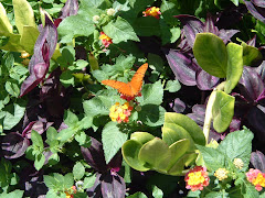
We also visited a Butterfly House. You walked into this glass room and there were plants from all over the world. The butterflies comes from the Rain Forest in South America. Music (Kenny G) was playing as you walked around and saw all the different kinds of butterflies. It was a truly relaxing time.
After we went to St. Anne's Church. It was started by the Jesuits who came to convert the Native Americans.
We then had lunch at the Yankee Rebel Tavern.
There are no automobiles on Mackinac Island. They have been forbidden since 1898. People get around by bicycles, horse drawn wagons, and foot. You can rent a horse and buggy if you choose. They have bikes for rent, and you can take a taxi which his a horse and wagon.
We stopped at many interesting points along the way. For instance we stopped and climbed the stairs to Arch Rock. It towers 146 feet above the road. The Arch rock is a perforated breccia mass. The Arch Rock formation is one of the natural wonders of the Midwest.
We rode about 2 miles and then stopped and had peanut butter and crackers along the shore. Then continued another 2 miles and then turned on the British Landing Road. When the War of 1812 broke out the British landed secretly on the island. The Americans surrendered to the British.
We also visited a Butterfly House. You walked into this glass room and there were plants from all over the world. The butterflies comes from the Rain Forest in South America. Music (Kenny G) was playing as you walked around and saw all the different kinds of butterflies. It was a truly relaxing time.
After we went to St. Anne's Church. It was started by the Jesuits who came to convert the Native Americans.
We then had lunch at the Yankee Rebel Tavern.
Tuesday, July 22, 2008
A Bear of a Travel Day
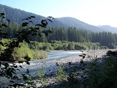
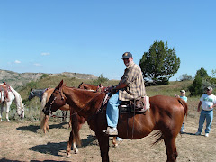
Today was a travel day as we departed Canada for the Upper Peninsula. Most of the 100 or so miles in Canada we skirted Lake Huron or drove directly beside the beautiful Mississagi River. As you can see from the photo, traffic was a bear. Speaking of bears, a Black bear ran across the road in front of us this morning. I do not know if bears gallop but I would say he was moving right along. We entered the US after customs made a cursory search of our camper. We arrived at the Newberry (MI) KOA and will use this as a base for sightseeing over the next couple of days.
Monday, July 21, 2008
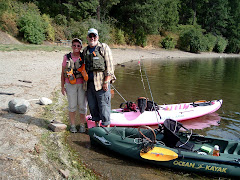
Kayacking the Serpent
Steve and I kayaked the Serpent River from just above the Spragge KOA boat launch down into the North Channel. Steve says the North Channel is part of Lake Huron so technically we kayaked on a Great Lake. To date we have kayaked a large inland lake, a river, and a swimming pool. The latter was a lot warmer but no where near as much fun. Tomorrow it's on to Michigan.
Change of Plans
We arrived at Mississagi Provincial Park around 4 p.m. and could not get our camper on a site. The land was sloping too much to be able to level. So we pulled out the maps and Good Sam Travel Guide and found a KOA in Spragge, Ontario, on the Serpent River.
We have been doing laundry and blogging to keep current. We are going to kayak this afternoon on the Serpent River which goes into the North Channel and into Lake Huron.
We have been doing laundry and blogging to keep current. We are going to kayak this afternoon on the Serpent River which goes into the North Channel and into Lake Huron.
Sunday, July 20, 2008
TRAVELING TO MISSISSAGI PROVINCIAL PARK
We left the park at 8:15 this morning and drove into North Bay to use their dump station at the Information Center. We are sitting here updating our blog. We think of you all often and wish you could see this beautiful country. We will add to our blog later.
Love to you all and talk to you soon.
Love to you all and talk to you soon.
ALGONQUIN PROVINCIAL PARK
We arrived at Algonquin Provincial Park around 4. We left Ottawa at 9:00 a.m. It was a long but beautiful ride. Some of the trans Canada highway, Route 417 changing to 17, was a lot bumpy. Some of the clothes hanging in the closet fell out.
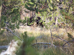
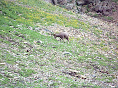
We got site 7 which is the most beautiful site I think we have ever had. We are less than forty feet from the lake. The name of the lake is Kioshkokwi (Kiosk for short). The wind was blowing quite hard here so we did not put up the canopy. On Monday the wind was strong with almost one foot high waves. We took the Kayaks out to do a little fishing. We had to keep paddling back out because the waves brought us into shore. On Tuesday we left at 7:30 a.m. on calm waters and kayaked 6 km to the west side of the lake. It took us almost 2 hours. While we were kayaking into a cove that had a large marsh, we saw two moose come out of the woods. There was a mother and a baby (this was a large baby). We paddled closer and just watched them. The mother never took her eyes off of us. It was amazing! We stayed for a little while and then the mother and baby just strolled back into the woods.
There was also a loon on the lake. I don’t know if the older boys remember when we went camping on Conway, NH. We could here and see the loons on Conway Lake. Loons can swim under the water for a very long time. You see them and then they dive and then you have to watch for quite a while and you will see them come up far away.
As we left the cove and continued across the lake we saw two more moose. Another mother and a smaller baby. They watch us for a few minutes and then went back into the woods. We were gone for five hours that day.
On Tuesday the water pump began to act up. The water pressure was very low and the pump made a terrible sound. On Wednesday Steve checked it out and found the pump was leaking. We checked with the office here and the lady let Steve call an RV dealer and they had one in stock. Steve wanted to buy a repair kit and the guy said these pumps are throw and go. This means for $118.00 you buy a new one. We drove into North Bay, Ontario, about 90 km from here. When we got back he put it in and as with pretty much everything in this camper, the pump works better than the original one. Now we had enough water pressure to take a shower.
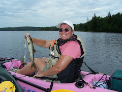
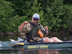
On Thursday we went out in our kayaks on the lake again and went 4 km in the other direction. We took our time and were gone 5 ½ hours this time. We did a lot of fishing and Steve caught two small mouth bass. One was about 2 pounds and the other was 11/2 pounds. They put up a good fight. His rod was really bent over. I caught a lake trout that was about 14 inches long. It was a successful day fishing.
We got site 7 which is the most beautiful site I think we have ever had. We are less than forty feet from the lake. The name of the lake is Kioshkokwi (Kiosk for short). The wind was blowing quite hard here so we did not put up the canopy. On Monday the wind was strong with almost one foot high waves. We took the Kayaks out to do a little fishing. We had to keep paddling back out because the waves brought us into shore. On Tuesday we left at 7:30 a.m. on calm waters and kayaked 6 km to the west side of the lake. It took us almost 2 hours. While we were kayaking into a cove that had a large marsh, we saw two moose come out of the woods. There was a mother and a baby (this was a large baby). We paddled closer and just watched them. The mother never took her eyes off of us. It was amazing! We stayed for a little while and then the mother and baby just strolled back into the woods.
There was also a loon on the lake. I don’t know if the older boys remember when we went camping on Conway, NH. We could here and see the loons on Conway Lake. Loons can swim under the water for a very long time. You see them and then they dive and then you have to watch for quite a while and you will see them come up far away.
As we left the cove and continued across the lake we saw two more moose. Another mother and a smaller baby. They watch us for a few minutes and then went back into the woods. We were gone for five hours that day.
On Tuesday the water pump began to act up. The water pressure was very low and the pump made a terrible sound. On Wednesday Steve checked it out and found the pump was leaking. We checked with the office here and the lady let Steve call an RV dealer and they had one in stock. Steve wanted to buy a repair kit and the guy said these pumps are throw and go. This means for $118.00 you buy a new one. We drove into North Bay, Ontario, about 90 km from here. When we got back he put it in and as with pretty much everything in this camper, the pump works better than the original one. Now we had enough water pressure to take a shower.
On Thursday we went out in our kayaks on the lake again and went 4 km in the other direction. We took our time and were gone 5 ½ hours this time. We did a lot of fishing and Steve caught two small mouth bass. One was about 2 pounds and the other was 11/2 pounds. They put up a good fight. His rod was really bent over. I caught a lake trout that was about 14 inches long. It was a successful day fishing.
OTTAWA, ONTARIO
On Thursday July 10th we left Vermont and entered Canada in Cornwall. We drove through upper New York State and crossed the border into Canada. The border guard was very friendly. He asked if we knew anyone in Canada and we said, “No.” He was surprised.
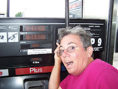
We stopped at a gas station to change some of our money into Canadian dollars. $200 Canadian dollars cost us $222.00 American. We are not sure what a bank exchange rate is but when we stopped in New York at a Citizens Bank, they did not exchange and sent us to the gas station.
From Cornwall we drove to Ottawa. The trans Canada highway is beautiful. The speed limit is 90 kph (55) which is our favorite speed to drive. I drove from Vermont to Ottawa. We arrived at the Ottawa Municipal Campground. What a nice place. We had electric and water and got spoiled for three days. On Friday we went into Ottawa for the day. The Bytown Trolley company sent a trolley to the campground and picked us up and one other family. We left the campground at 8:45 a.m. It was a 30 minute ride into downtown. When we arrived we bought a trolley ticket for a one hour tour of the city and then drop off and get on around the city.
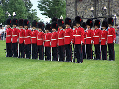
Before we took the one hour tour we went directly to Parliamentary Hill for the changing of the guard. We got there early and were able to get a great spot to view the ceremony. It was very impressive. There was a band, Scottish bagpipe players, and three companies of soldiers. The ceremony took 30 minutes and the music was awesome. After the ceremony we took a self guided tour around the grounds of the Parliament. We learned a lot about how Canada was formed. I don’t know about any of you reading this, but I was a little lacking in Canadian history.
The weather was beautiful for touring. We stopped at a deli to get a sandwich and then sat outside to eat. Sparks Street is a pedestrian mall. It covers 4 blocks and there are no cars allowed. Also if you ride your bicycle through this mall you can be fined $53.67.
We then took the one hour trolley tour and even went across the Ottawa River into Gatineau, Quebec. There were many interesting sites, but one that impressed us was the Notre Dame Cathedral Basilica. The construction began in 1827. Inside was so beautiful.
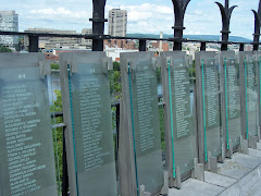
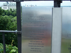
We then went back to Parliament Hill and went up in the Peace Tower. You can look out over the entire city of Ottawa. This tower was built from 1919 to 1927 and was dedicated to the more than 60,000 Canadian soldiers who gave their lives on the battlefields of Europe during the First World War standing 92.2 meters (302 feet, 6 inches) tall. The Pease Tower is a campanile: a free-standing bell tower. It houses the carillon, a set of bells sounded from a keyboard. There are 53 bells in the Peace Tower. The largest is called the “bourdon” and weighs in at 10,160 kilograms (22,000 pounds)—that’s roughly the weight of three adult elephants! The smallest bell weights 4.5 kilograms (10 pounds).
On Saturday we had to go grocery shopping. I wanted some beer and they do not sell any liquor, beer, or wine in a grocery store. As we were driving around we found The Beer Store. This is where you buy your beer. We shopped at Loblaws which was a super grocery store. Things cost so much more in Canada.
We left Ottawa in Sunday July 13th. It was over two hundred miles to Algonquin Provincial Park where we were headed for the next week. We stopped at a dairy bar called Laurentian View Dairy in Deep River Ontario. Steve had a breakfast meal and I had soup and a open-faced sandwich. It was scrumptious! Of course we had to try their ice cream and it was delicious. I had orange ice cream with a chocolate ribbon and Steve had Boston Crème.
We stopped at a gas station to change some of our money into Canadian dollars. $200 Canadian dollars cost us $222.00 American. We are not sure what a bank exchange rate is but when we stopped in New York at a Citizens Bank, they did not exchange and sent us to the gas station.
From Cornwall we drove to Ottawa. The trans Canada highway is beautiful. The speed limit is 90 kph (55) which is our favorite speed to drive. I drove from Vermont to Ottawa. We arrived at the Ottawa Municipal Campground. What a nice place. We had electric and water and got spoiled for three days. On Friday we went into Ottawa for the day. The Bytown Trolley company sent a trolley to the campground and picked us up and one other family. We left the campground at 8:45 a.m. It was a 30 minute ride into downtown. When we arrived we bought a trolley ticket for a one hour tour of the city and then drop off and get on around the city.
Before we took the one hour tour we went directly to Parliamentary Hill for the changing of the guard. We got there early and were able to get a great spot to view the ceremony. It was very impressive. There was a band, Scottish bagpipe players, and three companies of soldiers. The ceremony took 30 minutes and the music was awesome. After the ceremony we took a self guided tour around the grounds of the Parliament. We learned a lot about how Canada was formed. I don’t know about any of you reading this, but I was a little lacking in Canadian history.
The weather was beautiful for touring. We stopped at a deli to get a sandwich and then sat outside to eat. Sparks Street is a pedestrian mall. It covers 4 blocks and there are no cars allowed. Also if you ride your bicycle through this mall you can be fined $53.67.
We then took the one hour trolley tour and even went across the Ottawa River into Gatineau, Quebec. There were many interesting sites, but one that impressed us was the Notre Dame Cathedral Basilica. The construction began in 1827. Inside was so beautiful.
We then went back to Parliament Hill and went up in the Peace Tower. You can look out over the entire city of Ottawa. This tower was built from 1919 to 1927 and was dedicated to the more than 60,000 Canadian soldiers who gave their lives on the battlefields of Europe during the First World War standing 92.2 meters (302 feet, 6 inches) tall. The Pease Tower is a campanile: a free-standing bell tower. It houses the carillon, a set of bells sounded from a keyboard. There are 53 bells in the Peace Tower. The largest is called the “bourdon” and weighs in at 10,160 kilograms (22,000 pounds)—that’s roughly the weight of three adult elephants! The smallest bell weights 4.5 kilograms (10 pounds).
On Saturday we had to go grocery shopping. I wanted some beer and they do not sell any liquor, beer, or wine in a grocery store. As we were driving around we found The Beer Store. This is where you buy your beer. We shopped at Loblaws which was a super grocery store. Things cost so much more in Canada.
We left Ottawa in Sunday July 13th. It was over two hundred miles to Algonquin Provincial Park where we were headed for the next week. We stopped at a dairy bar called Laurentian View Dairy in Deep River Ontario. Steve had a breakfast meal and I had soup and a open-faced sandwich. It was scrumptious! Of course we had to try their ice cream and it was delicious. I had orange ice cream with a chocolate ribbon and Steve had Boston Crème.
MORE NORTH HERO STATE PARK VERMONT
The following is from the brochure put out by the Isle La Motte Preservation Trust: “The Isle La Motte in Vermont has an ancient reef believed to be almost half a billion years old. It is the world’s oldest reef in which corals first appear. The Isle La Motte is home to the most complete fossil record of the Chazy Reef. This reef began taking shape 480 million years ago at te bottom of a warm shallow sea south of the earth’s equator during what geologists all the Ordovician Period. Over a period of 10 million years, the reef grew from the calcium carbonate remains of he creatures in this ecosystem. Though the reef once stretched a thousand miles along the proto North American continent, most of it has disappeared or been destroyed by mountain building and other geologic forces. Only a few remnants of the great reef remain.”
We went to the Goodsell Ridge, the most famous reef site on Isle La Motte
We went to the Goodsell Ridge, the most famous reef site on Isle La Motte
Saturday, July 12, 2008
North Hero State Park, Vermont
We arrived at North Hero State Park in Vermont on Monday July 7, 2008. It was terribly muggy about 88 degrees and enough mosquitoes to carry one adult off. We coated up with OFF and set up camp. We had a beautiful secluded site. The park was barely one third full.
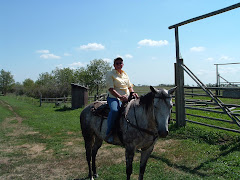
We tried out our Kayaks and they work great! We are getting better at taking them off and getting them back on. Lake Champlain is a beautiful lake. We stayed around the beach as we wanted to become familiar with them.
We rode our bicycles on Tuesday for about 10 miles. It was mostly along the Lake and what a gorgoeus site. We kayaked again on Wednesday. It was fun. The lake was a little choppy so we had to make sure we didn't get water in the kayaks. It was so cool!
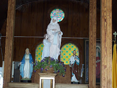
Wednesday we went in to Isle de la Motte and visited the Shrine of St. Anne (the mother of Mary). It was beautiful. They had an outdoor Stations of the Cross with a large crucifix. This was also right on the Lake. We then took our bikes and biked to an area that had fossils from millions of years ago. Then biked back to the truck.
Thursday we packed up and left for Canada. What a great spot in Vermont if you like to camp.
We tried out our Kayaks and they work great! We are getting better at taking them off and getting them back on. Lake Champlain is a beautiful lake. We stayed around the beach as we wanted to become familiar with them.
We rode our bicycles on Tuesday for about 10 miles. It was mostly along the Lake and what a gorgoeus site. We kayaked again on Wednesday. It was fun. The lake was a little choppy so we had to make sure we didn't get water in the kayaks. It was so cool!
Wednesday we went in to Isle de la Motte and visited the Shrine of St. Anne (the mother of Mary). It was beautiful. They had an outdoor Stations of the Cross with a large crucifix. This was also right on the Lake. We then took our bikes and biked to an area that had fossils from millions of years ago. Then biked back to the truck.
Thursday we packed up and left for Canada. What a great spot in Vermont if you like to camp.
Monday, July 7, 2008
Preparations
We have been gone from home for three weeks now. We stayed in Plymouth, New Hampshire, with Steve's Dad who is 94 for a week. Then we came to southern NH and attended Lily Rose's dance recital. Lily is my niece. Then we took Lily and her brother, Teddy, camping to Emerald Lake State Park in Dorset Vermont. We had a wonderful time hiking, fishing, having a campfire and just being together. The children love to play SORRY!
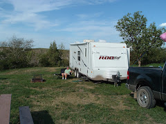
On Sunday June 29th a microburst came to Kate's and took our canopy and turned it over on top of our camper. We spent the next few days calling the insurance company and a camper place to get it fixed. Thanks to State Farm's fast work we got a brand new canopy and air vent on Thursday.
We then returned to Kate's and over the fourth of July six of the children came to visit. Our oldest son, Steve, got engaged on July 4th to Nicole. We are very happy. Nicole is a wonderful girl and she will make Steve a great wife. Welcome to the family, Nicole.
We also celebrated our second granddaughter, Gabriel's, first birthday. She is adorable and her sister, Elise, is also adorable. It was great to spend time with them.
We will miss everyone while we are gone, but you will all be in our thoughts as we travel around the country.
Sunday, July 6, 2008
Leaving for Vermont, the first leg of our adventure
July 7,2008
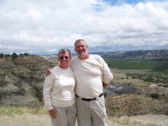
Here we are leaving my sister Kate's house in Windham, New Hampshire.
Here we are leaving my sister Kate's house in Windham, New Hampshire.
Subscribe to:
Comments (Atom)