Thursday, August 21, 2008
UNTIL WE MEET AGAIN
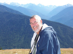
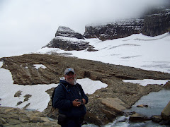
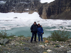
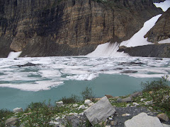
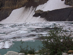
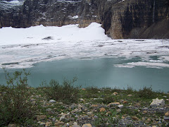
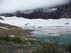
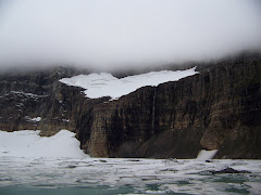
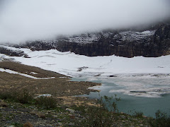
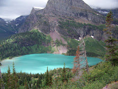
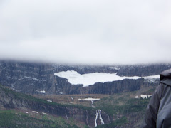
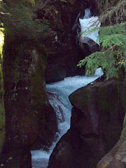
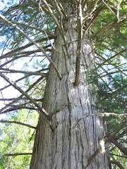
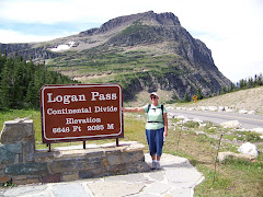
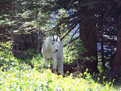
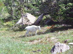
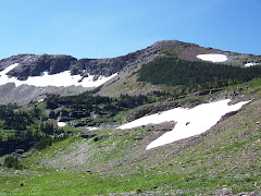
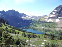
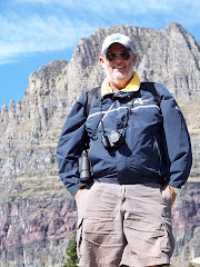
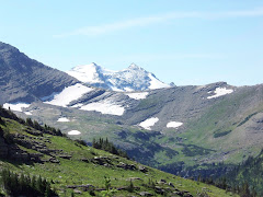
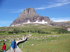
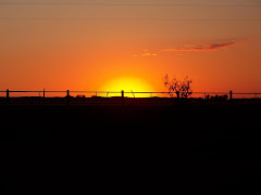
Well, we are going to be out of internet for awhile as we go to Glacier National Park. See you on the other side.
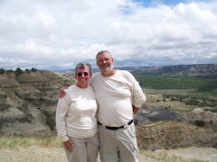
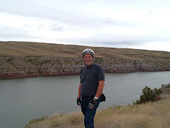
GREAT FALLS, MONTANA
We are now at Great Falls, Montana KOA. We are here to finish our preparations to go to Glacier National Park on Saturday. We will finish the laundry tomorrow and get a few groceries on the way out of town Saturday morning.
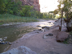
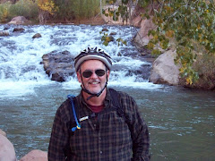
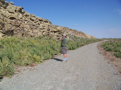
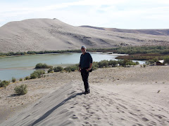
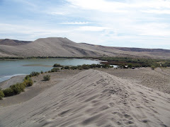
Today we went on the River Edge Trail along the Missouri River. We biked about 10 miles. Some on asphalt and some on a mountain bike trail. We went down some steep paths and then back up. It was scary and fun. I felt at one time I was flying in the air. We had a blast.
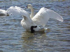
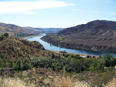
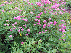
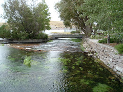
We also went to Great Spring State Park and saw the smallest river in the country. The Roe River starts from a spring and flows 53 feet into the longest river in the country, the Missouri River. The vegetation in this spring was marvelous. It was so green!
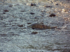
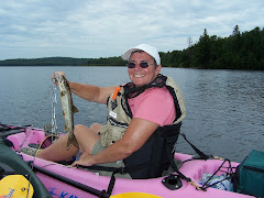
The state park also has a hatchery. They have a cement pond where you can watch large, jumbo size rainbow trout. They were magnificent. There was also some food you can buy for 5 cents and feed the trout. You could reach down and pull one out if you wanted to. What amazing fish.
Today we went on the River Edge Trail along the Missouri River. We biked about 10 miles. Some on asphalt and some on a mountain bike trail. We went down some steep paths and then back up. It was scary and fun. I felt at one time I was flying in the air. We had a blast.
We also went to Great Spring State Park and saw the smallest river in the country. The Roe River starts from a spring and flows 53 feet into the longest river in the country, the Missouri River. The vegetation in this spring was marvelous. It was so green!
The state park also has a hatchery. They have a cement pond where you can watch large, jumbo size rainbow trout. They were magnificent. There was also some food you can buy for 5 cents and feed the trout. You could reach down and pull one out if you wanted to. What amazing fish.
KOAs
8-17-8-19
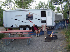
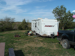
We stopped at Miles City, Montana, at a KOA for one night to make our trip to Billings shorter. We did laundry and groceries. There were lots and lots of bees.
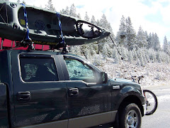
In Billings we found a car, trailer, semi carwash. We took the camper in to wash it as it was so dirty from all the gravel roads we traveled on to this point. Then we stopped at an RV service garage to get a tire on the camper looked at and discovered that the bands in the tire were gone. We got a new tire and also had the bearings greased. We have traveled 5,100 to this point since we left Virginia.
We got the truck washed and the oil changed, and then we got Precious a shampoo and a haircut. I also got to do some more laundry. All in all it was busy two days.
We stopped at Miles City, Montana, at a KOA for one night to make our trip to Billings shorter. We did laundry and groceries. There were lots and lots of bees.
In Billings we found a car, trailer, semi carwash. We took the camper in to wash it as it was so dirty from all the gravel roads we traveled on to this point. Then we stopped at an RV service garage to get a tire on the camper looked at and discovered that the bands in the tire were gone. We got a new tire and also had the bearings greased. We have traveled 5,100 to this point since we left Virginia.
We got the truck washed and the oil changed, and then we got Precious a shampoo and a haircut. I also got to do some more laundry. All in all it was busy two days.
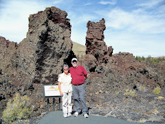
THEODORE ROOSEVELT NATIONAL PARK, NORTH DAKOTA
THEODORE ROOSEVELT NATIONAL PARK, NORTH UNIT
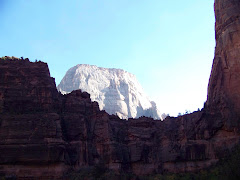
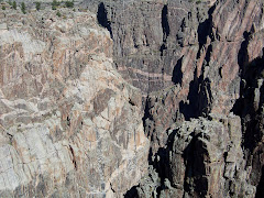
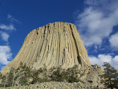
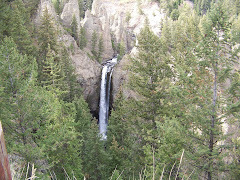
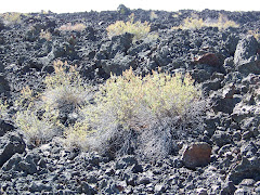
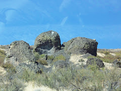
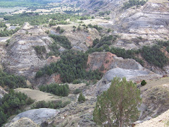
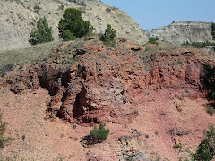
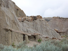
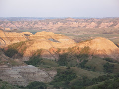
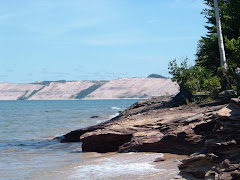
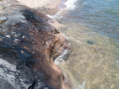
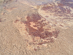
About 60 million years ago, streams carried eroded materials eastward from the young Rocky Mountains and deposited them on a vast lowland—today’s Great Plains. During the warm, rainy periods that followed, dense vegetation grew, fell into swampy areas, and was later buried by new layers of sediments. Eventually this plant material turned into lignite coal. Some plantlife became petrified. Today considerable amounts of petrified wood are exposed in the badlands. Bentonite, the blue-gray layer of clay, may be traced to ash form ancient volcanoes far to the west. But even as sediments were being deposited, streams were starting to cut down through the soft strata and to sculpt the infinite variety of buttes, tablelands, and valleys that make up the badlands we know today.
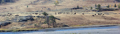
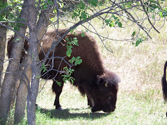
We drove the 14 mile road through the park stopping at many points along the way. We took a nature trail for .8 miles which pointed out and explained many of the different features of the badlands. We saw a herd of buffalo move into the river below an overlook. We also saw 2 mule deer, 1 white tail deer, and one wild turkey.
We took 5 hours to drive through the North Unit and we saw some spectacular sites.
SOUTH UNIT
On Friday we moved our camp to the southern unit of Theodore Roosevelt National Park. We got a nice site and then took a tour of this end of the park. The loop road was 36 miles long and we saw many of the same things as we did in the north unit.
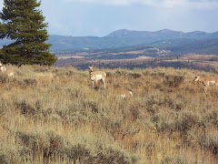
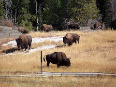
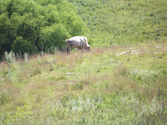
This unit is much more popular than the north. In the north unit there were probably not more than 10 cars as we passed through. The south unit, however, was very busy. As we entered the park to go to our campground we had to stop for a herd of buffalo to cross the street. They stopped right in the middle of the road and we had to sit. Needless to say, I got great pictures!
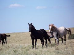
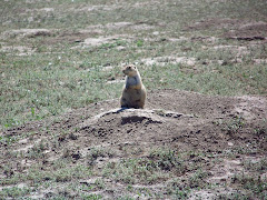
During our tour we saw several wild horses, and many, many prairie dogs that you could hear “barking”.
When we went to bed at night we saw the buffalo passing about 25 feet from the camper. They came right into the campground and passed through it to get water. I couldn’t get any pictures because Steve wouldn’t let me get out of the camper…
All in all Theodore Roosevelt National Park was the most interesting place to visit to experience the badlands and all their creatures.
About 60 million years ago, streams carried eroded materials eastward from the young Rocky Mountains and deposited them on a vast lowland—today’s Great Plains. During the warm, rainy periods that followed, dense vegetation grew, fell into swampy areas, and was later buried by new layers of sediments. Eventually this plant material turned into lignite coal. Some plantlife became petrified. Today considerable amounts of petrified wood are exposed in the badlands. Bentonite, the blue-gray layer of clay, may be traced to ash form ancient volcanoes far to the west. But even as sediments were being deposited, streams were starting to cut down through the soft strata and to sculpt the infinite variety of buttes, tablelands, and valleys that make up the badlands we know today.
We drove the 14 mile road through the park stopping at many points along the way. We took a nature trail for .8 miles which pointed out and explained many of the different features of the badlands. We saw a herd of buffalo move into the river below an overlook. We also saw 2 mule deer, 1 white tail deer, and one wild turkey.
We took 5 hours to drive through the North Unit and we saw some spectacular sites.
SOUTH UNIT
On Friday we moved our camp to the southern unit of Theodore Roosevelt National Park. We got a nice site and then took a tour of this end of the park. The loop road was 36 miles long and we saw many of the same things as we did in the north unit.
This unit is much more popular than the north. In the north unit there were probably not more than 10 cars as we passed through. The south unit, however, was very busy. As we entered the park to go to our campground we had to stop for a herd of buffalo to cross the street. They stopped right in the middle of the road and we had to sit. Needless to say, I got great pictures!
During our tour we saw several wild horses, and many, many prairie dogs that you could hear “barking”.
When we went to bed at night we saw the buffalo passing about 25 feet from the camper. They came right into the campground and passed through it to get water. I couldn’t get any pictures because Steve wouldn’t let me get out of the camper…
All in all Theodore Roosevelt National Park was the most interesting place to visit to experience the badlands and all their creatures.
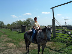
LITTLE MISSOUI STATE PARK, NORTH DAKOTA
8/13-15
Little Missouri is located 19 miles north of Killdeer, ND. The camp ground caters to horse riders. The park has corrals for horses and places to park the horse trailer/camper. We were the only regular campers, and there were two ladies (twin sisters) who had each their own mule who were staying there. They rode their mules twice a day.
The campground had four horses that roamed freely all the time. We looked outside the camper and watched them. There were also 4 rabbits in the early morning and evening.
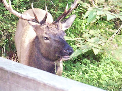
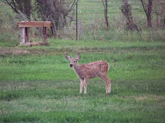
In the early evening across the badlands from our campground, we watched mule deer graze. This species of deer have long ears and very large antlers. The first evening we watched 3 males graze. What a beautiful sight!
One night you could hear the coyotes howl. What a sound! Steve also heard a bobcat catch something. He said the screaming was eerie.
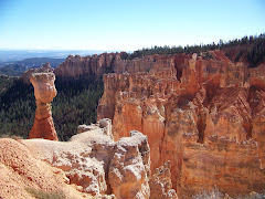
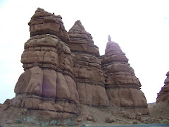
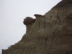
Little Missouri Park is in the Badlands of North Dakota. Badlands, what are they? Here’s what some say:
The Badlands...some call it "The Land God Forgot", others call it one of the most mysterious and beautiful places on Earth, still others liken its rugged terrain and awe inspiring rock formations to a lunar landscape. No matter what one sees in the Badlands, one thing is for certain...
"This broken country has been called always, by Indians, French voyagers, and American trappers alike, the Bad Lands." - Theodore Roosevelt
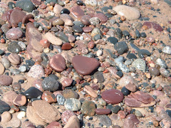
The Badlands is a region in the USA that includes western South Dakota and North Dakota marked by rugged terrain and formations that resemble a science fiction landscape of another world. These rock formations take on the shapes of domes, twisted canyons and slanted walls, often striped in different colors.
It is the most fascinating landscape so far. On Thursday we went to Theodore Roosevelt National Park, North Unit, for the day. More to come on that.
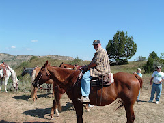
On Friday we took a trail ride into the Badlands from our campground. We were gone for two and a half hours. There was a guide, Lynelle who was 73 years old, and 6 other people on our ride. I rode Banda and Steve rode Peaches. The horses were very familiar with the trails, so we could really enjoy the view. We went on a medium trail which took us on the edge of cliffs and down steep hills. What an experience!
Little Missouri is located 19 miles north of Killdeer, ND. The camp ground caters to horse riders. The park has corrals for horses and places to park the horse trailer/camper. We were the only regular campers, and there were two ladies (twin sisters) who had each their own mule who were staying there. They rode their mules twice a day.
The campground had four horses that roamed freely all the time. We looked outside the camper and watched them. There were also 4 rabbits in the early morning and evening.
In the early evening across the badlands from our campground, we watched mule deer graze. This species of deer have long ears and very large antlers. The first evening we watched 3 males graze. What a beautiful sight!
One night you could hear the coyotes howl. What a sound! Steve also heard a bobcat catch something. He said the screaming was eerie.
Little Missouri Park is in the Badlands of North Dakota. Badlands, what are they? Here’s what some say:
The Badlands...some call it "The Land God Forgot", others call it one of the most mysterious and beautiful places on Earth, still others liken its rugged terrain and awe inspiring rock formations to a lunar landscape. No matter what one sees in the Badlands, one thing is for certain...
"This broken country has been called always, by Indians, French voyagers, and American trappers alike, the Bad Lands." - Theodore Roosevelt
The Badlands is a region in the USA that includes western South Dakota and North Dakota marked by rugged terrain and formations that resemble a science fiction landscape of another world. These rock formations take on the shapes of domes, twisted canyons and slanted walls, often striped in different colors.
It is the most fascinating landscape so far. On Thursday we went to Theodore Roosevelt National Park, North Unit, for the day. More to come on that.
On Friday we took a trail ride into the Badlands from our campground. We were gone for two and a half hours. There was a guide, Lynelle who was 73 years old, and 6 other people on our ride. I rode Banda and Steve rode Peaches. The horses were very familiar with the trails, so we could really enjoy the view. We went on a medium trail which took us on the edge of cliffs and down steep hills. What an experience!
SUNFLOWERS
One of the crops of North Dakota is sunflowers. As you drive along you see ahead of you field of yellow. They are so beautiful with their heads turned towards the sun. You can see miles and miles of them.
FORT ABRAHAM LINCOLN SP, MANDAN, ND
8/12
On the way to our this park we stopped in Jamestown, ND to see a herd of buffalo. They also have an albino buffalo named White Cloud considered to be sacred creatures by many Native American people. To some, they are a symbol of peace, unity and hope. To others, they are a sign of great changes in the world. To all, they are a blessing.
“For it was the White Buffalo Cow Woman who, in the beginning, brought to us our most sacred pipe, and from that time we have been relatives with the four-leggeds and all that amoves. Tatanka, the buffalo, is the closest four-legged relative that we have, and they live as a people, as we do.”—Black Elk, The Sacred Pipe, 1953.
White Cloud also has an albina baby, Dakota Miracle, born in the spring of 2007. We saw the herd at the Buffalo Museum.
Ft. Abe Lincoln State Park is a great place. Once again there were not many campers there and the campground was nice.
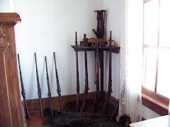
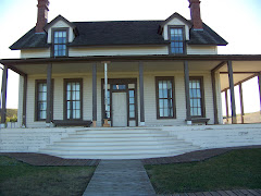
Fort Abraham Lincoln was once an important infantry and cavalry post. It was from this fort that Lt. Col. George Armstrong Custer and the Seventh Cavalry rode on their ill-fated expedition against the Sioux at the Little Big Horn. We toured the house where he lived with Mrs. Colonel Custer. The original house burned down not long after the Custers moved in and this house was built. Mrs. Custer made some changes from the original house. Apparently she was a little stuffy. She had her curtains from back home sent out to this house. She would talk to visitors at length about her curtains.
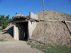
There is also a reconstructed Mandan Indian village. The earthlodges show the lifestyle of the Mandan Indians who occupied this site from about 1575-1781, The village is called On-A-Slant Indian Village. It was built on the bank of the Missouri River.
On the way to our this park we stopped in Jamestown, ND to see a herd of buffalo. They also have an albino buffalo named White Cloud considered to be sacred creatures by many Native American people. To some, they are a symbol of peace, unity and hope. To others, they are a sign of great changes in the world. To all, they are a blessing.
“For it was the White Buffalo Cow Woman who, in the beginning, brought to us our most sacred pipe, and from that time we have been relatives with the four-leggeds and all that amoves. Tatanka, the buffalo, is the closest four-legged relative that we have, and they live as a people, as we do.”—Black Elk, The Sacred Pipe, 1953.
White Cloud also has an albina baby, Dakota Miracle, born in the spring of 2007. We saw the herd at the Buffalo Museum.
Ft. Abe Lincoln State Park is a great place. Once again there were not many campers there and the campground was nice.
Fort Abraham Lincoln was once an important infantry and cavalry post. It was from this fort that Lt. Col. George Armstrong Custer and the Seventh Cavalry rode on their ill-fated expedition against the Sioux at the Little Big Horn. We toured the house where he lived with Mrs. Colonel Custer. The original house burned down not long after the Custers moved in and this house was built. Mrs. Custer made some changes from the original house. Apparently she was a little stuffy. She had her curtains from back home sent out to this house. She would talk to visitors at length about her curtains.
There is also a reconstructed Mandan Indian village. The earthlodges show the lifestyle of the Mandan Indians who occupied this site from about 1575-1781, The village is called On-A-Slant Indian Village. It was built on the bank of the Missouri River.
FORT RANSOM, ND
8/10-11
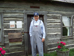
We arrived at Fort Ransom on Sunday. We used the GPS to get us there and it took us over 7 miles of gravel road to the state park. It was exciting to say the least. We did not meet any cars on the way, thank goodness, because the road was not very wide. This road is listed as an “American ByWay”. It really was nice. We stopped at a little cabin we saw on the way to the park. It was Slattum’s Cabin. As we were walking to the cabin to read the interpretive sign, a gentleman drove up and asked if we wanted to go inside. This man was the great grandson of Mr. Slattum who built the cabin. It was very small as you can see from the picture. Mr. Slattum came from Norway and he and his wife raised 9 children in this small cabin. He walked from south Minnesota to settle in this region of North Dakota.
Next on to Fort Ransom and a gorgeous camp site. There were only 6 other campers in the park.
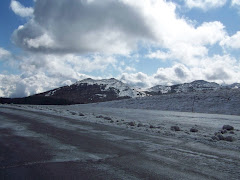
We took a ride to the overlook and looked at the area. It was awesome. The sign gave an explanation of how North Dakota was formed. Eastern North Dakota was covered by the Western Interior Seaway between 60 and 90 million years ago. This warm subtropical sea was less than 500 feet deep and stretched from the Arctic Ocean to the Gulf of Mexico. There are many fossils found in the area. Three layers of rock (called formations) extend over eastern North Dakota. These formations, which began as sediments washed into the sea, were deposited along the shoreline on the seashore.
Sandstone was deposited along the fluctuating shoreline, with shale and limestone forming on the bottom in deeper waters.
It rained all day Monday. This was the first day since we left from Kate’s on July 7th that we really couldn’t do anything. It was a good day to catch up on rest, reading, and a couple of videos.
We arrived at Fort Ransom on Sunday. We used the GPS to get us there and it took us over 7 miles of gravel road to the state park. It was exciting to say the least. We did not meet any cars on the way, thank goodness, because the road was not very wide. This road is listed as an “American ByWay”. It really was nice. We stopped at a little cabin we saw on the way to the park. It was Slattum’s Cabin. As we were walking to the cabin to read the interpretive sign, a gentleman drove up and asked if we wanted to go inside. This man was the great grandson of Mr. Slattum who built the cabin. It was very small as you can see from the picture. Mr. Slattum came from Norway and he and his wife raised 9 children in this small cabin. He walked from south Minnesota to settle in this region of North Dakota.
Next on to Fort Ransom and a gorgeous camp site. There were only 6 other campers in the park.
We took a ride to the overlook and looked at the area. It was awesome. The sign gave an explanation of how North Dakota was formed. Eastern North Dakota was covered by the Western Interior Seaway between 60 and 90 million years ago. This warm subtropical sea was less than 500 feet deep and stretched from the Arctic Ocean to the Gulf of Mexico. There are many fossils found in the area. Three layers of rock (called formations) extend over eastern North Dakota. These formations, which began as sediments washed into the sea, were deposited along the shoreline on the seashore.
Sandstone was deposited along the fluctuating shoreline, with shale and limestone forming on the bottom in deeper waters.
It rained all day Monday. This was the first day since we left from Kate’s on July 7th that we really couldn’t do anything. It was a good day to catch up on rest, reading, and a couple of videos.
BUFFALO RIVER SP, GLYNDON, MN
8/8-8/9
While driving to the park today we went through Frazee, MN and saw where your Thanksgiving turkeys come from. There were many large barns full of turkeys!
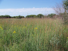
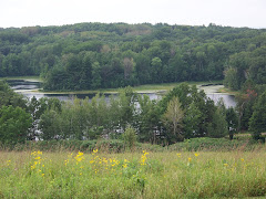
This park has one of Minnesota’s finest and largest remnant prairies. We took a 3 mile hike around the prairie. It was beautiful with many different kinds of trees, plants, and flowers. We saw three large birds that we were unable to identify; however, they live in the moist shady grass and fly really fast when you walk by.
After our hike we drove into Fargo, North Dakota to get some information on the next leg of our trip. We collected lots of information on things to see and do in North Dakota. We then went to a great restaurant, DooLittles, which had wood grilled chicken. It was delicious.
This park also has a pond that they keep clear with chlorine. They pump water in from the Buffalo River and then treat it and fill the pond. This is a very busy place on the weekends as the people in the area come for picnics and swimming.
Friday night we went to the Minnesota State University Science Center to look at the stars. They were supposed to have telescopes for everyone to look at, but the sky was overcast and we couldn’t see any stars. There was a power point presentation about the sun, planets, meteors, and comets. It was very interesting.
While driving to the park today we went through Frazee, MN and saw where your Thanksgiving turkeys come from. There were many large barns full of turkeys!
This park has one of Minnesota’s finest and largest remnant prairies. We took a 3 mile hike around the prairie. It was beautiful with many different kinds of trees, plants, and flowers. We saw three large birds that we were unable to identify; however, they live in the moist shady grass and fly really fast when you walk by.
After our hike we drove into Fargo, North Dakota to get some information on the next leg of our trip. We collected lots of information on things to see and do in North Dakota. We then went to a great restaurant, DooLittles, which had wood grilled chicken. It was delicious.
This park also has a pond that they keep clear with chlorine. They pump water in from the Buffalo River and then treat it and fill the pond. This is a very busy place on the weekends as the people in the area come for picnics and swimming.
Friday night we went to the Minnesota State University Science Center to look at the stars. They were supposed to have telescopes for everyone to look at, but the sky was overcast and we couldn’t see any stars. There was a power point presentation about the sun, planets, meteors, and comets. It was very interesting.
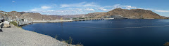
CROW WING SP, BRAINERD, MN
8/6-8/7
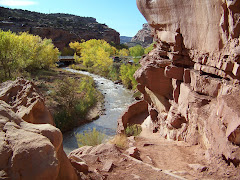
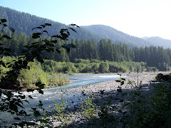
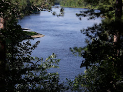
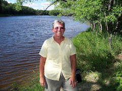
We arrived at Crow Wing State Park on Wednesday August 6th. We set up camp and then took a bike ride around the park. Our first stop was the Mississippi River. What a beautiful sight. We hiked to Chippewa Lookout for a view of the Misssippi from 400 ft above sea level. Then we continued around to see The Catholic Mission, where the Knights of Columbus rebuilt the mission; and the Lutheran Mission which had a plaque about the area.
“There is some disagreement about the origin of the name Crow Wing. Most agree that the 19th century town, the county and the state park honored the name of the river. Some claim that the river was so named because an island, prominently located at the confluence of the Mississippi and Crow Wing Rivers, is shaped like a crow's wing. Others claim that the name is a mistranslation of an Ojibwe word for raven or raven feather. Still others say that the name is derived from the Little Crow chiefdom and lineage of the Dakota, who inhabited this region before the Ojibwe. According to historian William Warren, this was the scene of a major battle between the Dakota and Ojibwe Indians in 1768. The fur trade era brought the voyageurs of the Northwest and American Fur Companies. Soon traders established posts along the rivers and a branch of the Red River Trail brought ox carts through the area. Leaders of the territory and the state settled here. Allen Morrison, the first citizen of Crow Wing, established a post below the southern mouth of the Crow Wing River in 1823. In 1847, Clement H. Beaulieu took over operations of the American Fur Company at Crow Wing and built a stately mansion in the frontier village. This Greek Revival structure survived the ages. It has recently been returned to its original location and is presently being restored. Missionaries came to teach the Indians and build mission churches. The cemeteries remind us of the once thriving community.” http://www.dnr.state.mn.us/state_parks/crow_wing/narrative.html
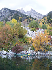
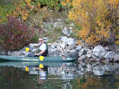
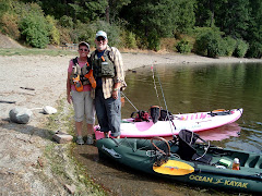
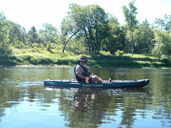
On Thursday we kayaked the Mississippi River. It was a lot of fun. There was a good current going down the river. As usual when we kayak, on the return trip the wind and current were against us and it was quite a challenge to get back to where we put in. We had beautiful weather and wonderful time just looking and listening.
We arrived at Crow Wing State Park on Wednesday August 6th. We set up camp and then took a bike ride around the park. Our first stop was the Mississippi River. What a beautiful sight. We hiked to Chippewa Lookout for a view of the Misssippi from 400 ft above sea level. Then we continued around to see The Catholic Mission, where the Knights of Columbus rebuilt the mission; and the Lutheran Mission which had a plaque about the area.
“There is some disagreement about the origin of the name Crow Wing. Most agree that the 19th century town, the county and the state park honored the name of the river. Some claim that the river was so named because an island, prominently located at the confluence of the Mississippi and Crow Wing Rivers, is shaped like a crow's wing. Others claim that the name is a mistranslation of an Ojibwe word for raven or raven feather. Still others say that the name is derived from the Little Crow chiefdom and lineage of the Dakota, who inhabited this region before the Ojibwe. According to historian William Warren, this was the scene of a major battle between the Dakota and Ojibwe Indians in 1768. The fur trade era brought the voyageurs of the Northwest and American Fur Companies. Soon traders established posts along the rivers and a branch of the Red River Trail brought ox carts through the area. Leaders of the territory and the state settled here. Allen Morrison, the first citizen of Crow Wing, established a post below the southern mouth of the Crow Wing River in 1823. In 1847, Clement H. Beaulieu took over operations of the American Fur Company at Crow Wing and built a stately mansion in the frontier village. This Greek Revival structure survived the ages. It has recently been returned to its original location and is presently being restored. Missionaries came to teach the Indians and build mission churches. The cemeteries remind us of the once thriving community.” http://www.dnr.state.mn.us/state_parks/crow_wing/narrative.html
On Thursday we kayaked the Mississippi River. It was a lot of fun. There was a good current going down the river. As usual when we kayak, on the return trip the wind and current were against us and it was quite a challenge to get back to where we put in. We had beautiful weather and wonderful time just looking and listening.
Tuesday, August 5, 2008
Chippewa Moraine
If you want to know more about the Ice Age and formation of Wisconsin go to the following website. It shows the museum we went to. Have fun!
http://www.dnr.state.wi.us/org/LAND/parks/specific/chipmoraine/
http://www.dnr.state.wi.us/org/LAND/parks/specific/chipmoraine/
Grand Island Casino RV Resort
We decided to go to Grand Casino RV Park Resort. We are in Hinckley, Minnesota, and have a nice site. The campground has 271 sites but not all are filled. You can take a shuttle to the casino next door from your campsite. You just put the red flag down. The shuttle runs 24 hours a day because the casino is opened for 24 hours. We went Monday evening and played slots for about 2 ½ hours. We came out about $18.00 ahead.
Today, Tuesday, we worked on planning our trip since we have internet. We have made some reservations because we have discovered some of the places we want to visit have few openings. Also, the retired Steve forgot that the first weekend in September was Labor Day weekend.
We went over to the casino to play some more slots and have a buffet lunch in the Grand Casino Restaurant. It was a delicious lunch and we had a fun time with the machines. We came out about $2.00 ahead for the two days.
We are sitting in the laundry right now catching up on dirty clothes. We were going to swim in the pool right outside the laundry, but some child had an accident in the pool so it is closed…
We will leave on Wednesday morning and go to Brainerd, Minnesota, to Crow Wing State Park. This is a flyway for birds. We will also get to kayak on the Mississippi River.
Chippewa Moraine Unit--Ice Trail
On Monday we left Brunet and headed west to Minnesota. On the way out of Wisconsin we went to Chippewa Moraine Unit along the Ice Age Trail. There we visited an interpretive center that provided a unique glimpse into Wisconsin’s glacial past. It is one of the 9 units of the “Ice Age National Scientific Reserve Park”. It is amazing how the Wisconsin terrain was formed from glaciers.
Brunet Island State Park, Cornell, Wisconsin
We reached Wisconsin on Wednesday July 30th. We stayed at Hiawatha RV Resort for one night. It was a great campground. We had chance to get the laundry done.
On Thursday we went to Brunet Island State Park in Cornell, Wisconsin. The landscape in Chippewa County is a product of the most recent Ice Age (the Pliestocene Epoch). The rolling terrain carries a wide variety of forest types and is home to a multitude of wildlife. The campground has about 69 campsites. The North Campground did not have electricity but the sites were on the water. That is where we stayed. It is by far the most beautiful campsite on our trip. The site was large and private. We enjoyed watching Eastern Kingfishers “hawk” for bugs. They would dive down to the water and get a bug and return to a tree or bush.
We also saw a pileated woodpecker which is the largest of all woodpeckers.
I was not able to take a picture because my camera was broken. I have since bought a new one and now I am back in business.
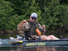
On Friday we kayaked around the island. It took us three hours. We always take our time and go into the coves. We started out on the Chippewa River and went into the Fisher River. On the way out of one of the coves we saw an otter swimming around.
On Saturday we took a 40-mile round trip bicycle ride on the Old Abe State Recreation Trail. It begins in Brunet Island State Park and goes to Lake Wissota State Park. The trail was an old railroad track that was taken out of service and paved. We had a great time, but we were very tired. It took approximately 7 hours to go down, eat a picnic at Lake Wissota, and then bike back.
On Sunday the weather was a little overcast, and so we went about 39 miles south to Eau Claire, Wisconsin, to get a new camera. This time we drove the truck.
On Thursday we went to Brunet Island State Park in Cornell, Wisconsin. The landscape in Chippewa County is a product of the most recent Ice Age (the Pliestocene Epoch). The rolling terrain carries a wide variety of forest types and is home to a multitude of wildlife. The campground has about 69 campsites. The North Campground did not have electricity but the sites were on the water. That is where we stayed. It is by far the most beautiful campsite on our trip. The site was large and private. We enjoyed watching Eastern Kingfishers “hawk” for bugs. They would dive down to the water and get a bug and return to a tree or bush.
We also saw a pileated woodpecker which is the largest of all woodpeckers.
I was not able to take a picture because my camera was broken. I have since bought a new one and now I am back in business.
On Friday we kayaked around the island. It took us three hours. We always take our time and go into the coves. We started out on the Chippewa River and went into the Fisher River. On the way out of one of the coves we saw an otter swimming around.
On Saturday we took a 40-mile round trip bicycle ride on the Old Abe State Recreation Trail. It begins in Brunet Island State Park and goes to Lake Wissota State Park. The trail was an old railroad track that was taken out of service and paved. We had a great time, but we were very tired. It took approximately 7 hours to go down, eat a picnic at Lake Wissota, and then bike back.
On Sunday the weather was a little overcast, and so we went about 39 miles south to Eau Claire, Wisconsin, to get a new camera. This time we drove the truck.
Subscribe to:
Posts (Atom)